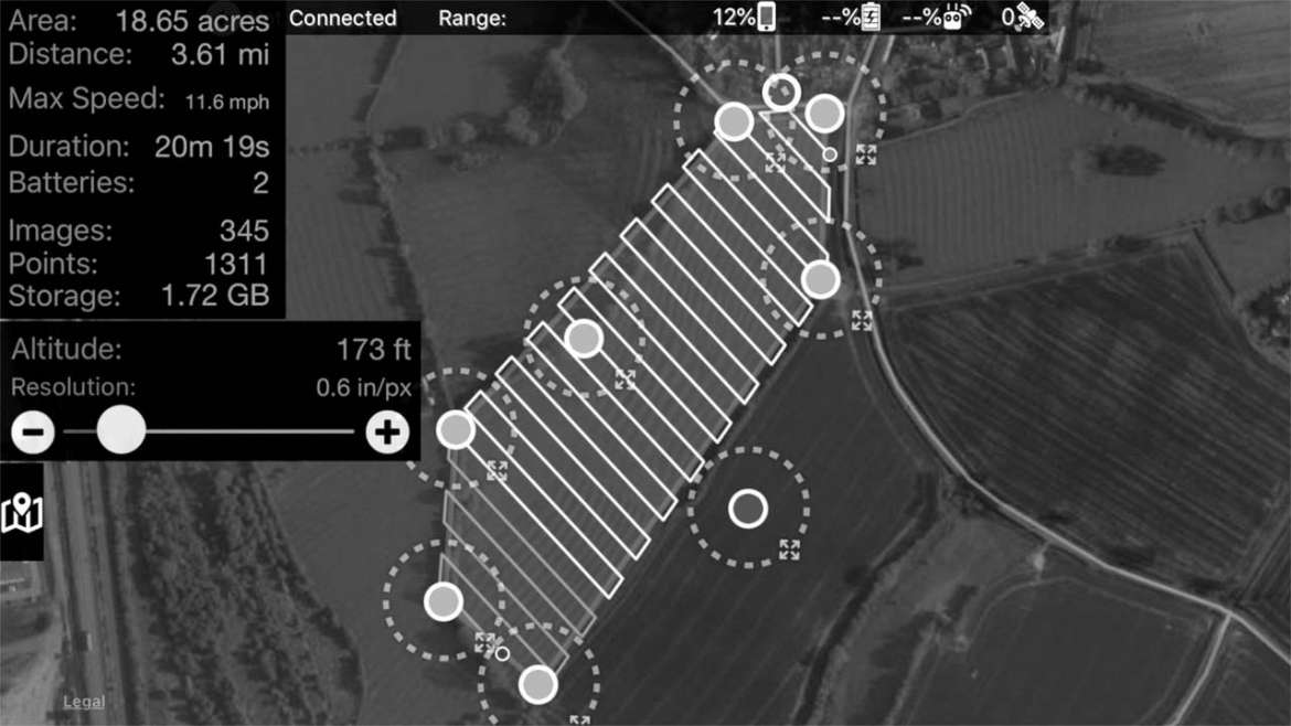
By accurately programming and controlling the flight path of a drone, including height, speed, focus and how often photographs are taken (referred to as a drone mission) detailed maps and 3D models of large areas can be created using specialised mapping software.
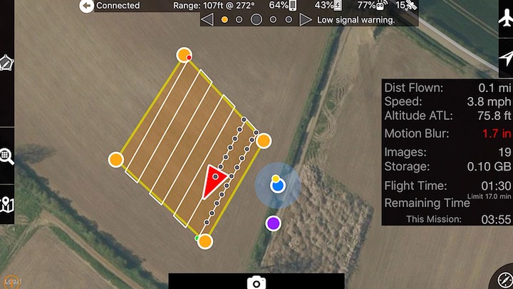
The image below shows a flight path mission programmed into the drone. The drone is depicted as a red triangle following the white-lined flight path. The image also shows small dots behind the drone where photos have been taken. When the mission is complete the drone returns home and all images are transferred to a computer and stitched together using the mapping software.
All missions can be saved and repeated as many times as required, for example, missions can be used every few weeks to see how a building project is progressing or how a crop field is growing so that remedial action can be taken if required.
In terms of a building project, having regular aerial maps can help project managers ensure things are going to plan and determine whether manpower needs to be increased to meet deadlines.
Having regular maps of crop fields created can help farmers keep track of which parts of a field may be underperforming. This then allows them to take remedial action by spraying pesticides directly into problem areas as apposed to the whole field, saving time and money.
Please note: the mission below is for illustration purposes only, as a whole field, rather than just a small section, would normally be mapped.
Our packages
These packages are the simplest, fastest approach to getting the support you need for your next project.
Take a look and select what you believe is the best starting-point for you and contact us!
All packages include can include a ground station/s as an optional extra for mm accurate mapping.